This moderately challenging hike is from a Country Walks book published (1980) by London Transport. It passes through the towns of Caterham, Chaldon, Coulsdon, Whyteleafe, Warlingham and Woldingham. On a sunny day, this is a great walk through valleys and pass churches. Expect quite a bit of ascending and descending in the second half.
Unfortunately, there is no convenient pub along the route for lunch, so pack a picnic and enjoy!
Caterham is very easy to get to from Central London: end of the line on Southern Trains. Change at East Croydon.
Waypoints
51.28203, -0.07826 - Caterham train station
Upon exiting the train station, take a right and walk up Church Street. It quickly becomes apparent that there is no pavement on the right, so you'll need to cross the road and walk up the hill on the left. Its a steep climb to start the hike!
51.28127, -0.10565 - Rook Lane
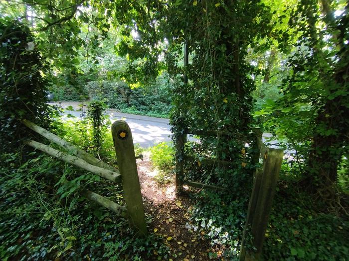
When walking west on Rook Lane, stay on the left side pavement to avoid hopping back and forth. Seems short pavements are in vogue here. As you advance, keep your eyes peeled for an opening in the bushes across the road. The first one can be easy to miss, but there is another chance 20 metres further along. If walking in spring or summer, this is the beginnings of a day of thorns.
51.28487, -0.1211
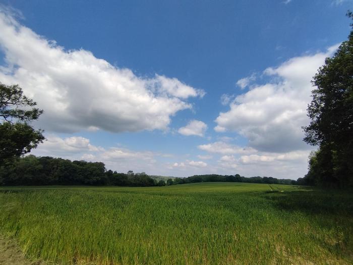
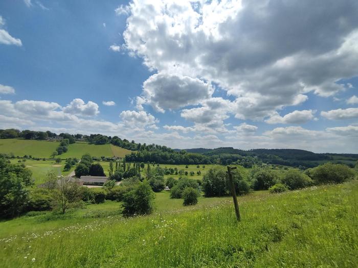
As you finish walking past Piles Wood on the right, you are greeted by a wonderful field of crops. Don't worry, you'll be back in here soon.
51.28494, -0.12356 - Our second church of the day
Here you'll find St. Peter and St. Paul's Church, Chaldon. If time allows, take a look around and have a short break before the fun begins.
51.2857, -0.12389 - A landmark
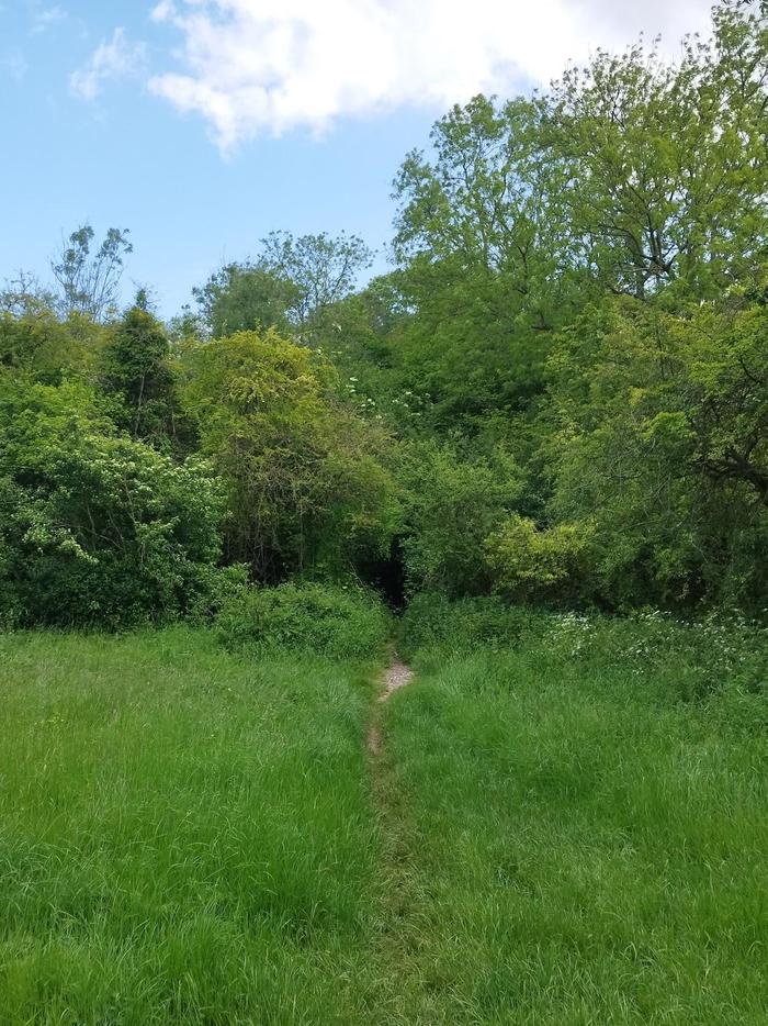
Walking a little up the road, you'll find a signpost signalling to Happy Valley. Walk a little further up and you'll reach the southernmost point of Greater London. Head back to the signpost and re-enter the crop field you had just left. Bear half left as you enter the field and walk straight.
51.29363, -0.11873 - Embrace jeopardy
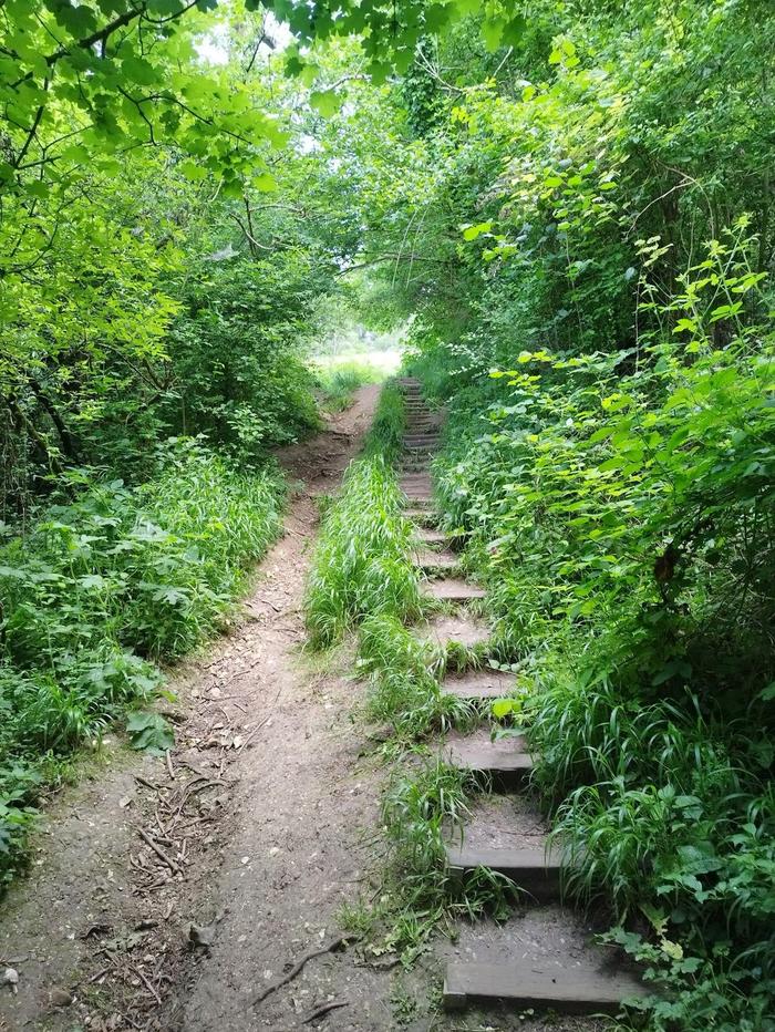
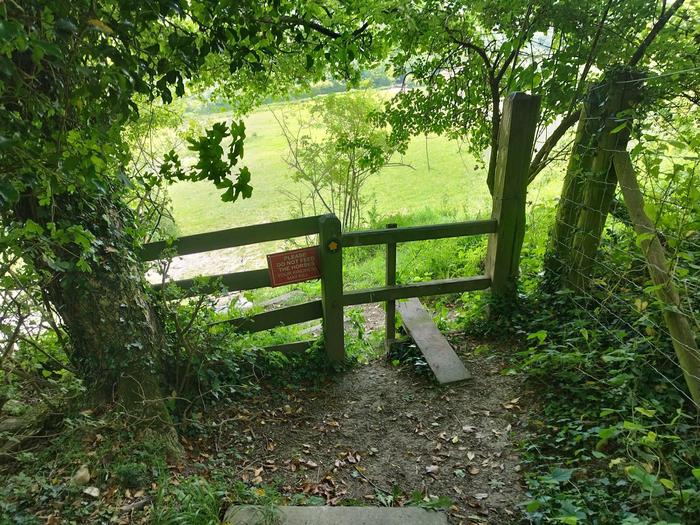
As you pass between Figgs Wood on the left and the aforementioned Piles Wood on the right, you'll head down the valley. Keep walking straight into what looks like a bush. A path does exist, trust me. You'll be met with a steep climb up some steps which disappear as quickly as they appeared. Luckily, there is a generous bench two-thirds up the ascent giving a place to rest overlooking the valley you just crossed.
51.29563, -0.11184
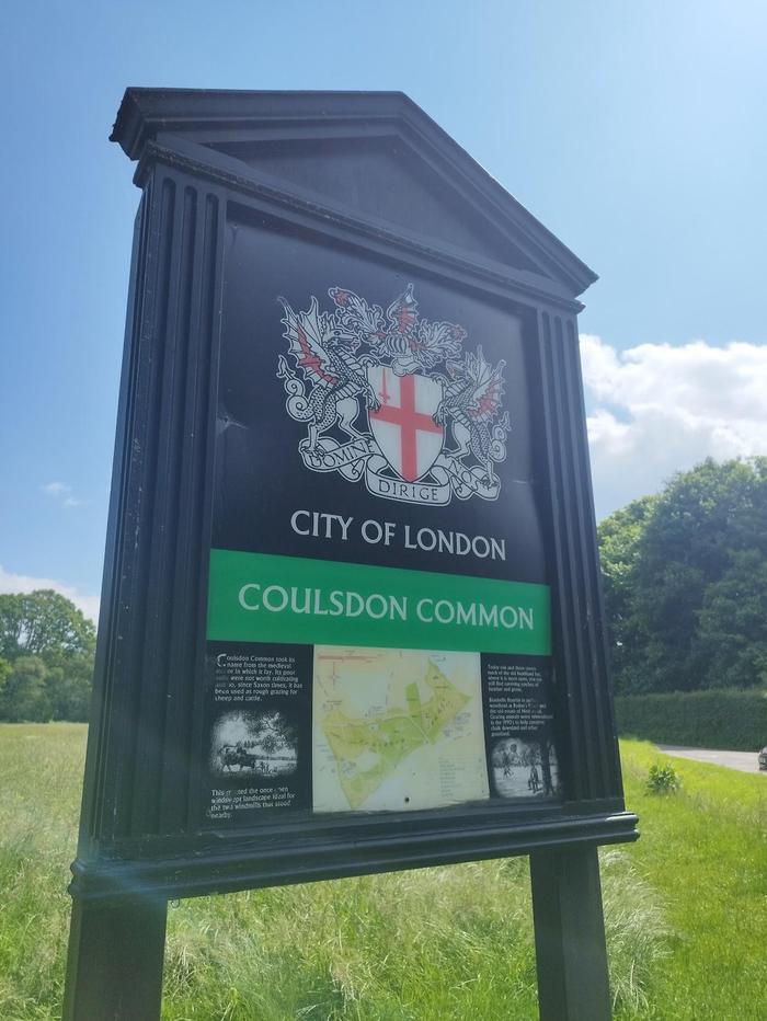
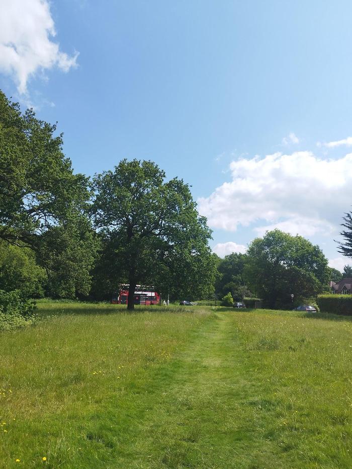
Exiting the Happy Valley car park, you enter Coulsdon which turns out to be part of the City of London. Despite your best efforts to leave London for the day, you reluctantly walk back into it while noticing the familiar bus stops and red double-decker buses speeding past. Sigh. Take care crossing the busy Coulsdon Road before entering Coulsdon Common proper.
51.30749, -0.10421
Enter Betts Mead Recreation Ground.
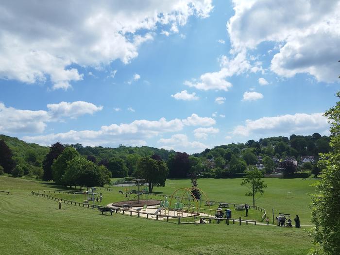
51.31263, -0.07663 - Lunch!
Here Whyteleafe Recreation Ground marks the half-way point. 10km walked! This is a great spot for lunch; there are a few benches near the children's playground. If you didn't bring a picnic, there is a small cafe at the bottom of the park. Be sure to rest, but not for too long. You'll be in for some fun in the second half where progress will be a lot slower.
51.31371, -0.07392 - The pain begins...
The book gives wonderful descriptions on the route so that this whole hike can be done without GPS. Here, it mentions a path once you're parallel to the tennis courts. What it failed to mention was the ridiculous incline.
51.31606, -0.06824 - A crawl through time
You'll encounter lots of signs saying driveways are private, proceed with respect and you'll be fine. The ones you walk on today are public footpaths. This next one, unfortunately, is not as well kept as others. Running down the side of some Victorian houses, crawl through the thorn bushes and trees. Again, trust me. As you pick off the thorns on your arms and legs, emerge into a small opening, you are greeted by a signpost signalling a public footpath which hasn't seen daylight in many years. You can't help but give a wry smile. Eventually, you'll emerge into John Fisher's Sports Ground. Walk along the edge of the sports field to the other side.
51.3025, -0.05316 - Bug Hill
While walking up Leas Road to Bug Hill, be sure not to miss the side road. Head down the slope. As you walk past the back of a house, you'll encounter a fork. Keep going straight.
51.30141, -0.05371 - Something seems wrong...
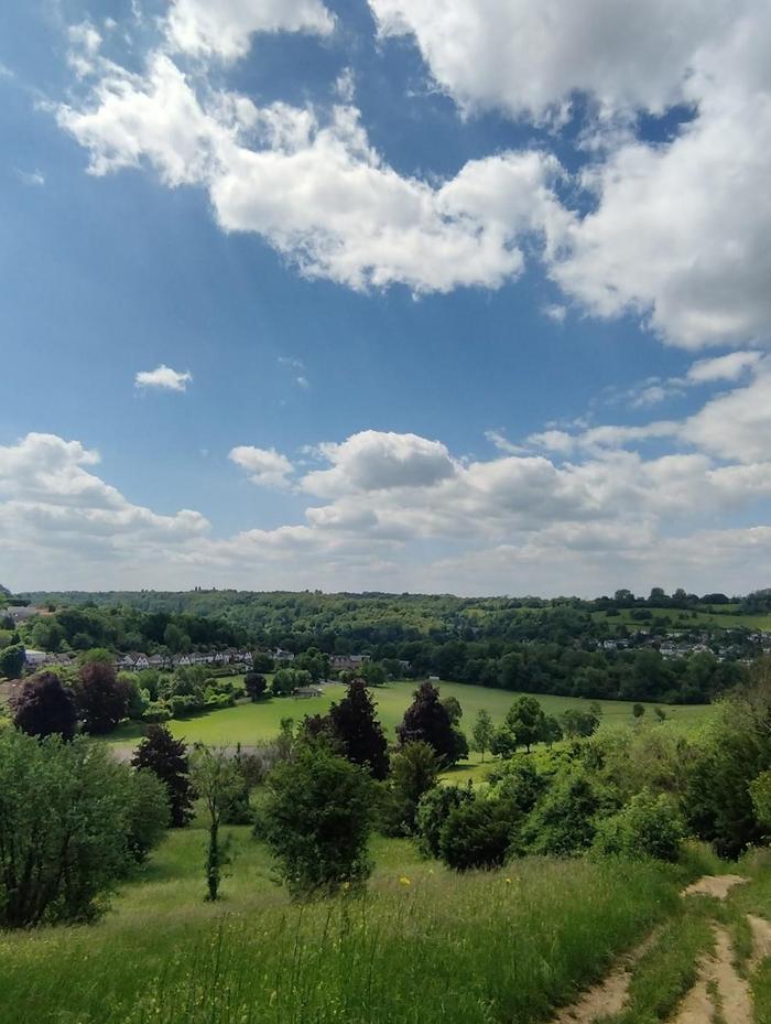
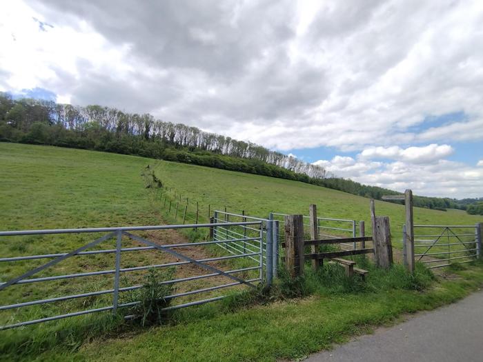
Here is my favourite part of the walk (sarcasm). The book suggests walking forward down the hill across to the other side of the field and over some stiles. Unfortunately, what lies ahead these days is a golf course. A signpost does signal the public footpath still exists across the golf course. If you are confident in golf etiquette (I wasn't), feel free to walk on through. Alternatively, and if you are up for some jeopardy, take the dubious dirt path to the right. Skirt around the golf course on a steep slope, through thick thorns and dense trees. Take good care of where you place your feet.
51.28525, -0.04361 - A short breather
On passing a stile, take a short break on some well placed logs. If you're in luck, you'll see lots of horses. Magestic animals. As you can probably guess, you'll be descending the valley and then climbing yet again shortly after.
51.28499, -0.05184 - The final climb?
Have to be honest here, this one nearly ended me. By this point, I was done with climbing any more. But alas, this next stretch was the hardest. When you reach the stile at the tree line, you'll realise it keeps on going (but with steps). When you're really at the top, we'll do it all again. You'll eventually reach what the book calls a 'modern house'. To its side, is another incline along a narrow path. Keep going, you're nearly there.
51.28099, -0.07065 - Oh, there's a dual carriageway to cross too
After passing through a new housing estate you'll be greeted by the exhilarating sounds of cars at 60mph. A small opening in the trees takes you graciously down to the road side. Look right first. Spot an opening in the cars and commit. Then repeat while looking left. You've made it back to Caterham. Head back to the train station to finish the walk.


 51.28203, -0.07826 - Caterham train station