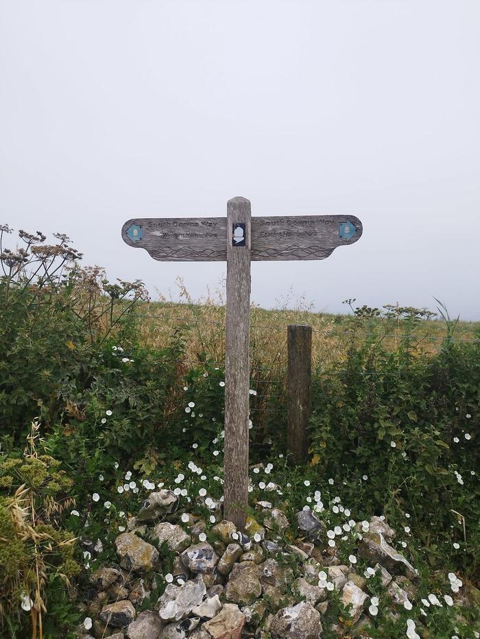
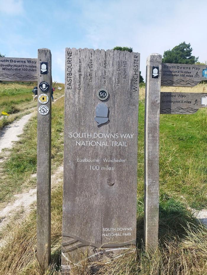
The South Downs Way was my first thru-hike, and even my first ever experience at camping too. I first came across it when walking Ditchling Beacons and Seven Sisters. There were sign posts dotted around and it stuck with me ever since. It was a toss up between this and the North Downs Way, which I have actually walked more of, but the South Downs seemed a little more appealing.
Planning for this hike was relatively easy with lots of information online. I knew I wanted to camp as much as I could, but stick with campsites rather than wild camp. This would be my first time camping, so I needed to get used to my equipment and workflow. Having campsite facilities meant I just felt a little more comfortable.
I used the following to plan each day's route and destination:
AllTrails - always my starting point for any walk. The GPX file was also loaded onto my Garmin GPSMAP device for en route navigation.
Google Maps - for looking for campsites and refuelling points. Also Street View for evaluating any potential scary road crossings.
Trailblazer South Downs Way guidebook - I only thought to buy this the day before I started the hike, and it was satisfying much of my planning was similarly mentioned in the book.
After many years of only doing one day hikes in and about London, and even in other countries, I really wanted to try a multi-day hike. I wanted to find out whether I'd like camping and whether the longer distances is something I was actually looking for. Safe to say, at the end of the South Downs Way, it would be yes to both. Even so, I had a lot of time for contemplating on the hike:
Be satisfied by walking 20km a day. I had originally planned to walk the whole South Days Way in only 5 days, however, after the first day of 35km it was obvious my body was not fit to do that. Without carrying a large backpack, I previously had walked 20km in about 4-5 hours. 35km with a 13kg backpack took me 9 hours and I was too tired to actually enjoy the walk - something which was really important to me.
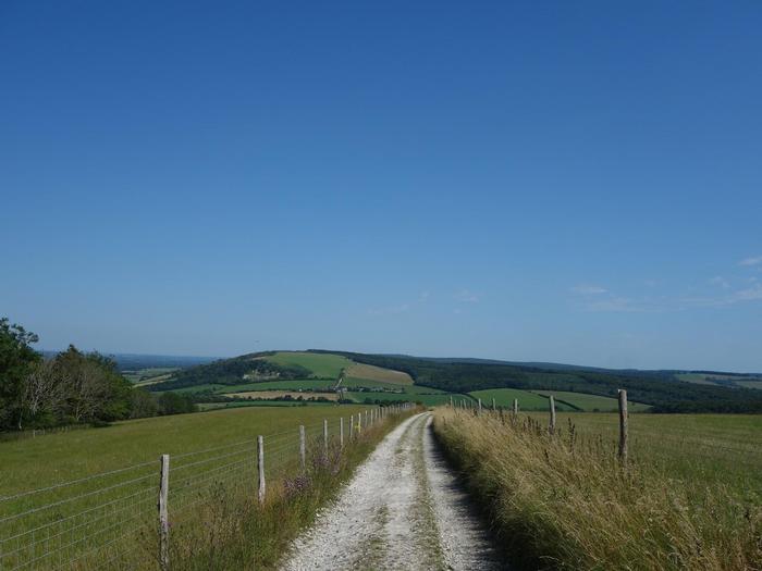
The paths on the South Downs Way have a lot of stones and they hurt. The first few days were the most brutal on the feet. Small and large stones for kilometres meant I had to really learn how to walk differently so to give parts of my feet a rest of the onslaught. Trail runners are great, but I'd actually suggest proper hiking boots.
I enjoy smashing out a section really early in the morning so I have lunch and the rest of the day to rest and relax. Time off the trail could be enjoyed alongside the walking.
There were times I was 99% sure I wanted to give up. Either the path became incredibly monotonous and boring, or I was just in too much pain to enjoy walking further. But persevering to the end has its charms.
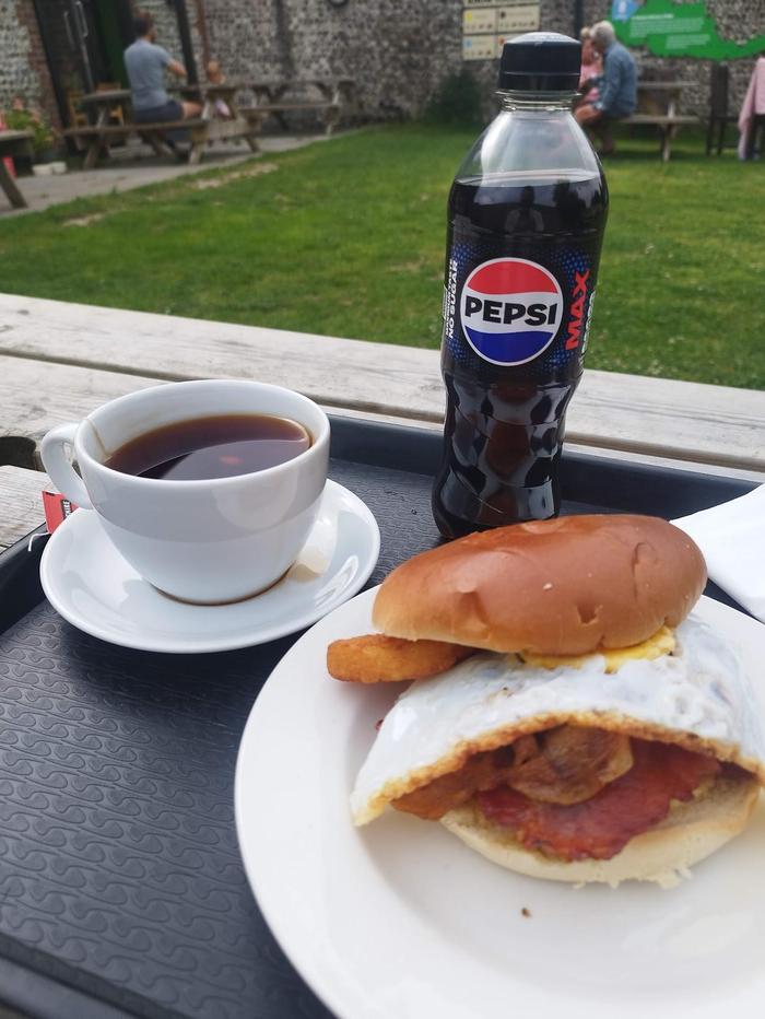
Eating was hard for me. Often times, I would just want to power through without breakfast or lunch. But that was dangerous, even more so I was walking in a 30C heatwave and much of the trail was in open fields. I had plenty of water, but not enough food to give me energy and help recover faster.
Accommodation
Day
Start
Finish
Accommodation
1
Winchester
East Meon
Sustainability Centre
2
East Meon
Cocking
Manor Farm
3
Cocking
Amberley
Black House Pub
4
Amberley
Truleigh Hill
YHA Truleigh Hill
5
Truleigh Hill
Kingston near Lewes
Housedean Farm Campsite
6
Kingston near Lewes
Alfriston
Alfriston Camping Park
7
Alfriston
Eastbourne
(Train home)
Finding accommodation along the trail wasn't too difficult; lots of people have posted information online and the Trailblazers guide has many suggestions. Some time was spent making sure I had relatively even distances for each day, and that accommodation was not too far away from the trail which would add on a lot of distance and unwanted descending/ascending.
Accommodation for day 3 and 6 were the only places which weren't directly on the trail. Black House Pub is about a 10 minute walk down a steep hill from the trail. Alfiston Camping Park is about 5 minutes outside the village centre.
It also just so happened that accommodation was located before a big climb, so my legs were fresh and ready to tackle them in the mornings.
Distances
Day
Start
Finish
Distance (km)
Elevation (m)
1
Winchester
East Meon
35
642
2
East Meon
Cocking
28
618
3
Cocking
Amberley
22
402
4
Amberley
Truleigh Hill
26
597
5
Truleigh Hill
Kingston near Lewes
23
519
6
Kingston near Lewes
Alfriston
24
559
7
Alfriston
Eastbourne
20
621
Total
178
3958
As previously mentioned, I tried to keep each day relatively even in terms of kilometres. I did make some mistakes however.
I originally planned to walk the trail in 5 days which meant distances of ~35km per day. After the first day, my hamstrings were not in the condition to continue such distances, so I scaled each day down. It also meant I could enjoy the walk rather than focussing on the pain.
Day 4 had 22km planned, but it turned out to be 26km. I must have made a mistake reading the map.
I also knew day 7 would be 18km to the official end of the South Downs Way, but would be walking extra to get to Eastbourne train station.
Performance
Finally, after the South Downs Way was conquered, here are the performance numbers per day. I definitely was not targeting any goals; finishing the whole trail while having fun was the aim.
Day
Start
Finish
Moving time (hrs)
Average pace (mins/km)
Section time (hrs)
Calories
1
Winchester
East Meon
6:45
11:40
8:37
3696
2
East Meon
Cocking
6:00
12:39
7:36
3055
3
Cocking
Amberley
4:48
12:45
7:06
2623
4
Amberley
Truleigh Hill
5:57
13:36
8:31
3242
5
Truleigh Hill
Kingston near Lewes
5:02
12:51
5:40
2164
6
Kingston near Lewes
Alfriston
5:16
12:52
6:29
2362
7
Alfriston
Eastbourne
4:40
13:48
5:10
1824
On the first day I tried to match my usual walking pace of 10 mins/km. That was a huge mistake given the extra distance and additional weight. Subsequent days were much more sensible and despite fatigue in the legs, I seemed to keep a consistent pace throughout. Days 4 and 7 had particularly challenging climbs which explains the slower page (more details on that later).
The additional distance (compared to the official 100 miles or 160 kilometres) can be attributed to getting to and from accommodation, food spots, or train stations; I tried to stick to the official route as much as I could but it gives a more realistic overall distance.
Waypoints
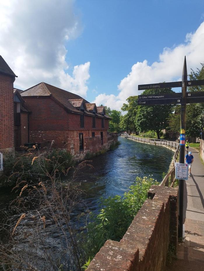
51.06718, -1.31971 - Winchester train station (Day 1)
The journey begins at Winchester train station. It is a 1.3km walk to the official start of the South Downs Way, but you get to pass the cathedral and stock up on last minute supplies and equipment if needed.
51.06134, -1.30795 - Winchester City Mill
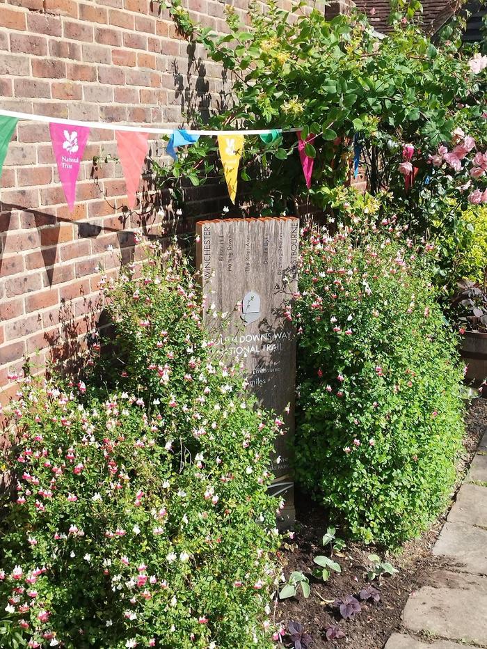
Winchester City Mill on the River Itchen is the official starting point of the South Downs Way. Don't cross the bridge but cross the road and head south on the The Wiers path.
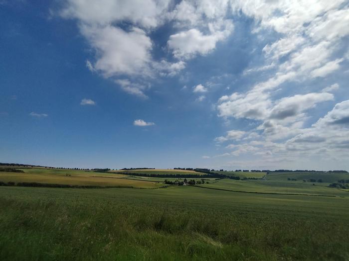
51.05037, -1.25898 - A step into the countryside
After crossing the M3, we leave Winchester and enter the countryside.
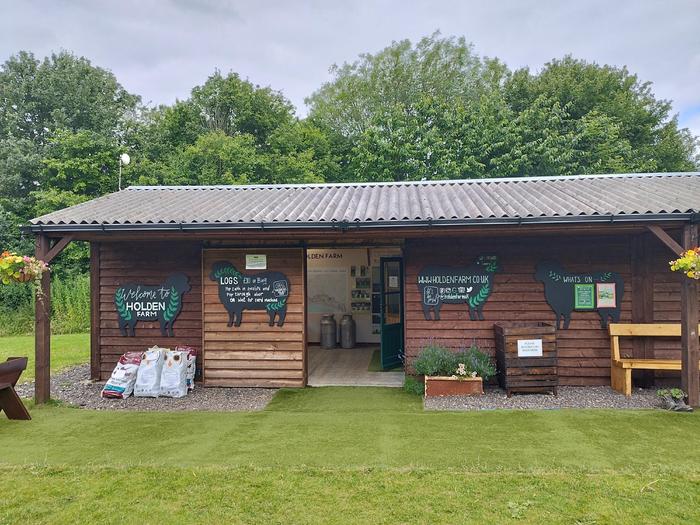
51.03766, -1.20031 - Holden Farm
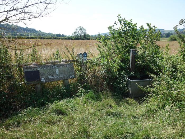
After a couple of hours of walking, Holden Farm is a great place for lunch. They sell sandwiches, sausage rolls and drinks. It is also a campsite and would make a great place for a first night if you arrived in Winchester late. There are clean toilets and a water tap too.
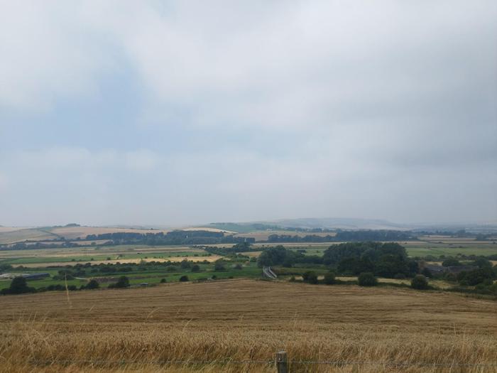
50.99823, -1.14207 - Beacon Hill
50.98053, -1.08665 - Old Winchester Hill
50.98988, -1.0673 - Meon Springs campsite and cafe
Another candidate for camping on the first day. It has a great cafe to refuel with a water tap round the back. In hindsight, I should have finished here. The final climb up to the Sustainability Centre was what killed my hamstrings, while walking in 30C sun.
50.96795, -1.03784 - Sustainability Centre (end of Day 1)
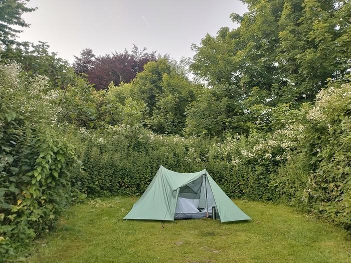
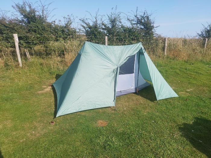
Having finally arrived at the Sustainability Centre after a gruelling 35km, I pitched my tent, cleaned myself up, forced down some food and slept very very well. The birds will be collectively singing in full around 5am (which I loved). A quick pack up and refill of water bottles meant I set off quite early the next morning.
50.96731, -1.03224 - A beautiful morning (Day 2)
50.97118, -0.982 - Butser Natural Nature Reserve
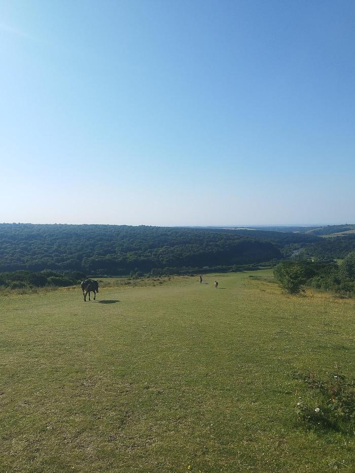
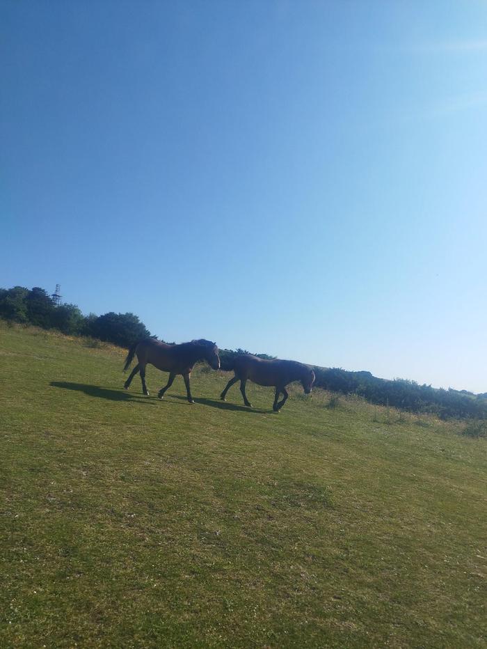
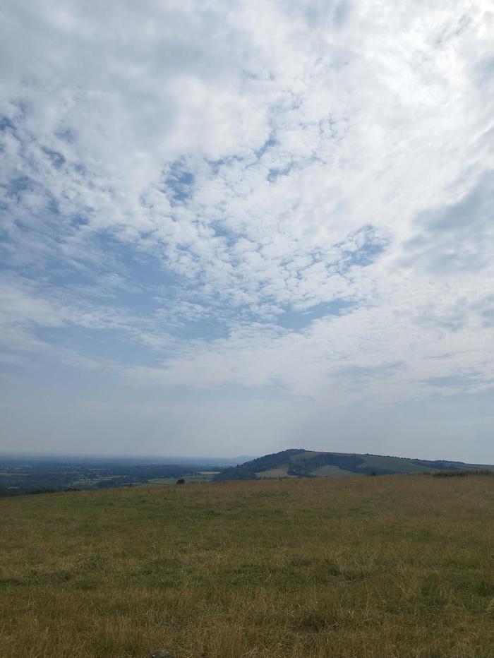
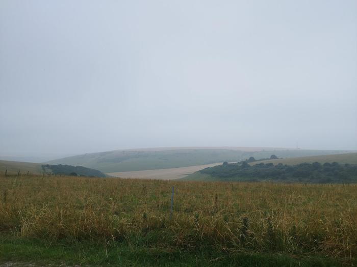
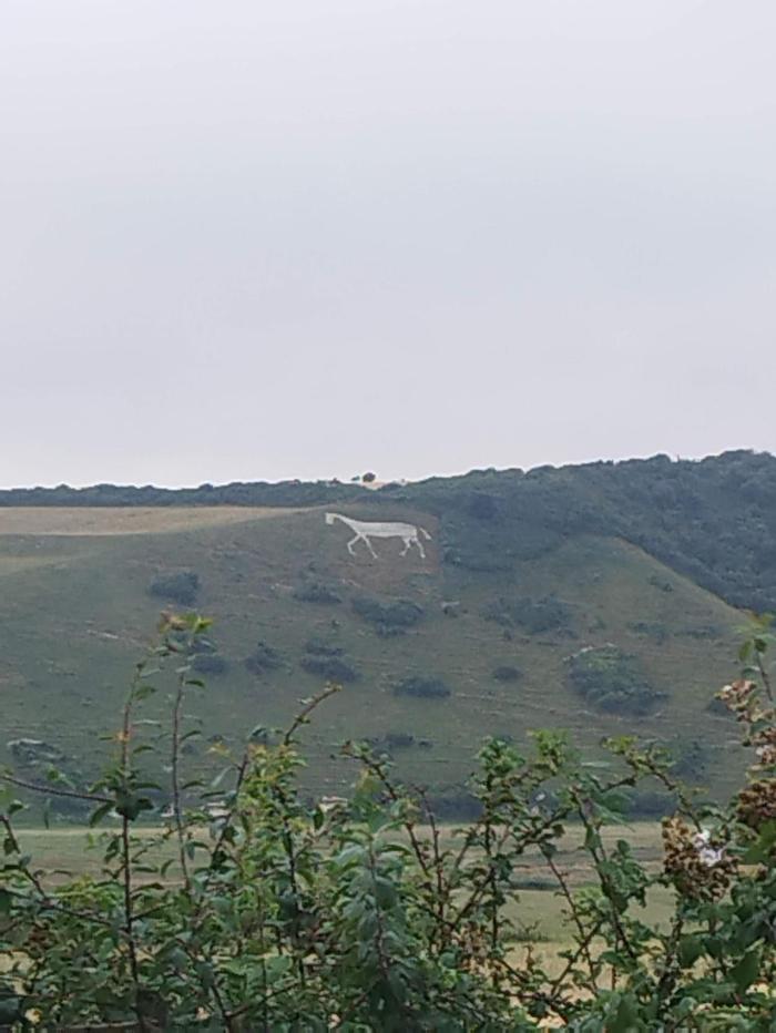
Walking through Butser Natural Nature Reserve was magical. It is one of the highest points on the South Downs Way, and looking down towards the chalk cliffs above the A3 road was incredible. What made it even more astonishing (with a drop of jeopardy) were the herd of horses galloping right next to me on the way down.
50.96087, -0.97715 - Queen Elizabeth Country Park
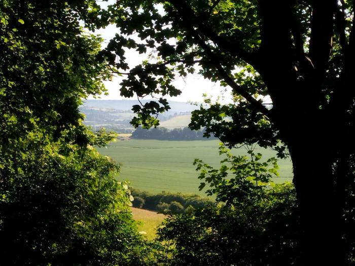
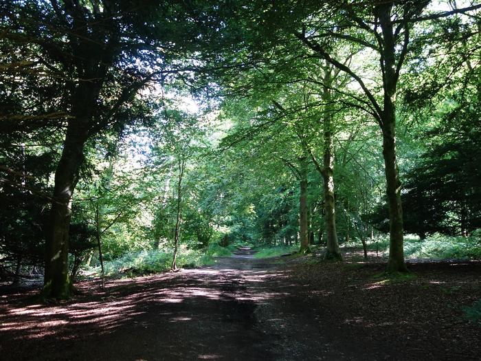
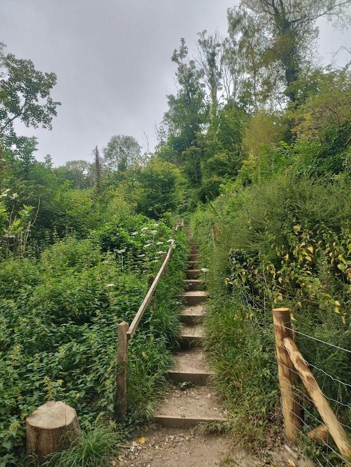
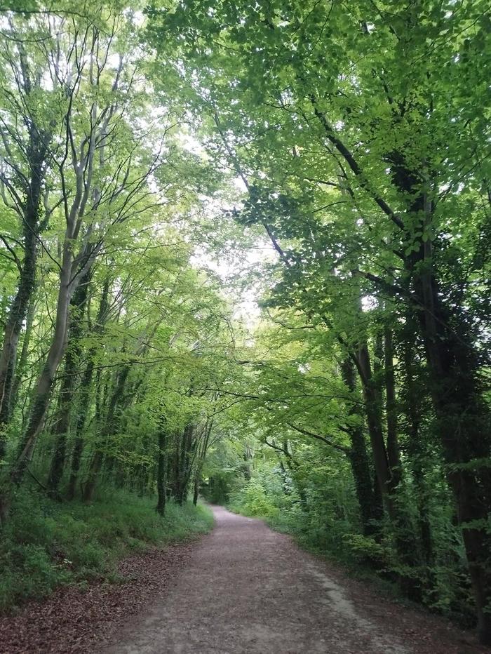
The woods in Queen Elizabeth Country Park were a delight, providing some welcome shade from the early morning sun. If so desired, don't take the wooden stairs up into the woods but rather the road to the cafe for breakfast and water. As you'll read, there are plenty of places for food on the trail, so minimal packing of food is needed for this walk.
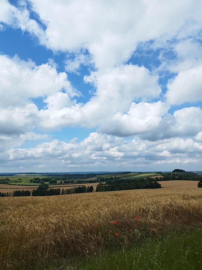
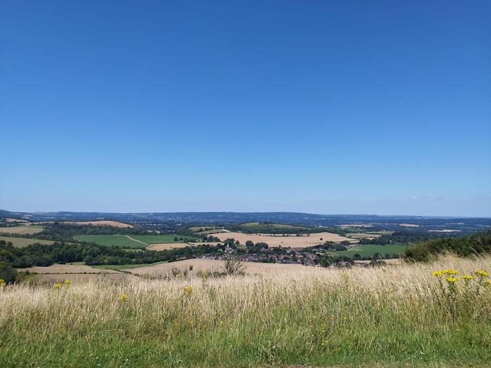
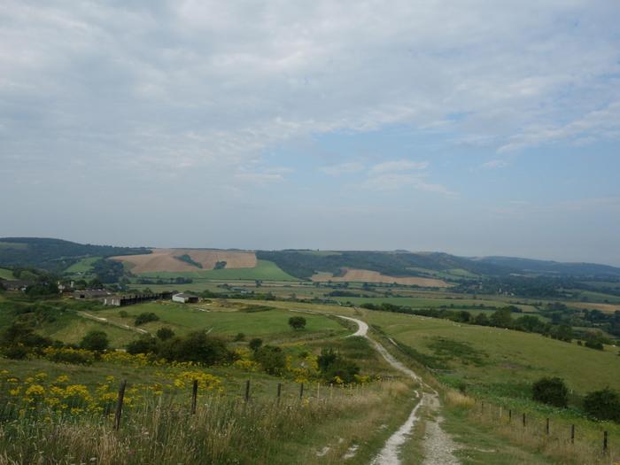
50.9597, -0.86846 - Harting Down
Harting Down is a wonderful place to pause for a break. It has great views over the villages of South Harting and East Harting. The rolling hills aren't too steep, so the ups and downs are quite fun.
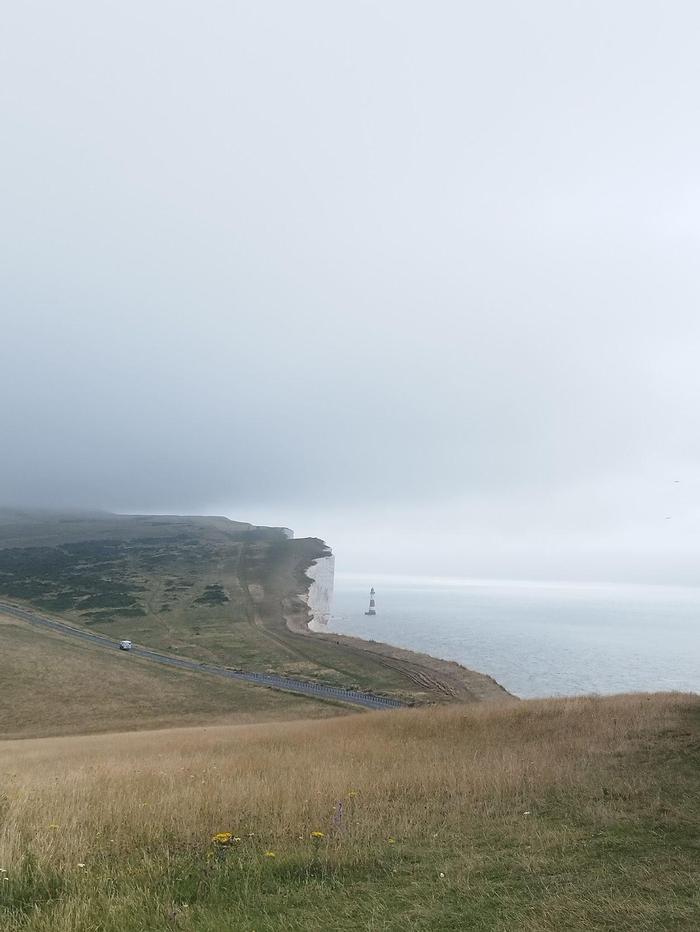
50.95286, -0.83198 - Beacon Hill
There is a steep direct path up Beacon Hill. I chose to stick to the official path just for completeness.
50.9424, -0.75054 - Manor Farm, Cocking (end of Day 2)
A straight path leads slowly down to Manor Farm, which is just south of Cocking. There is a Cadence cafe just before the crossroads with a water tap. It is an excellent place to grab some snacks and drinks if you don't feel like walking into Cocking proper and the highly recommended Blue Bell pub. Cadence cafes will appear regularly along the South Downs Way and are always a welcome sight! Manor Farm is located directly on the trail and its water tap is highly visible. It is a great place to camp and Pauline is an amazing host.
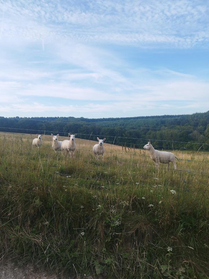
50.94087, -0.73119 - Morning animals (Day 3)
The day starts with a moderate climb. There are lots of farm animals, notably sheep, but also wild rabbits if you are lucky.
50.9222, -0.64889 - Littleton Farm Campsite and Cadence Cafe
This is an alternative campsite if you arrived at Manor Farm relatively early in the afternoon and want to walk a little more. Another Cadence cafe is right next door and is a great place to grab breakfast, and fill up water bottles, where ever you camped the night before.
50.90951, -0.60124 - Slindon Estate
50.90223, -0.54426 - Amberley (end of Day 3)
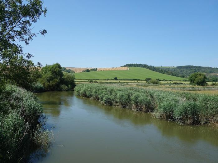
As we cross rivers and train tracks into Amberley, we have another water tap available and views of Amberley Castle. Would recommend taking a detour to Amberley Tea Rooms for a scenic bite to eat next to the river. The train station is also across the road in case you want to cut the trail in half. Since it was forecast to be 32C this afternoon, I had decided I wanted to set off at 7am and make it to Amberley for lunch, during which the sunshine was already really really hot. I walked a little further along the trail to the junction of Mill Lane, at which I took and walked down a steep road towards Amberley town. The Black Horse pub is a great place to stay mid-way through the walk. Wonderful rooms and great food too!
50.90277, -0.51614 - Amberley Mount (Day 4)
I chose to stop in Amberley because I knew there would be a really hard climb once you leave the town. In fact, today would feature three hard climbs so I would class this my hardest day. As you'll see later, it was also the most beautiful. The Black Horse pub packed a nutritious lunch for me, of which I decided I would eat for breakfast once I had conquered the first hill.
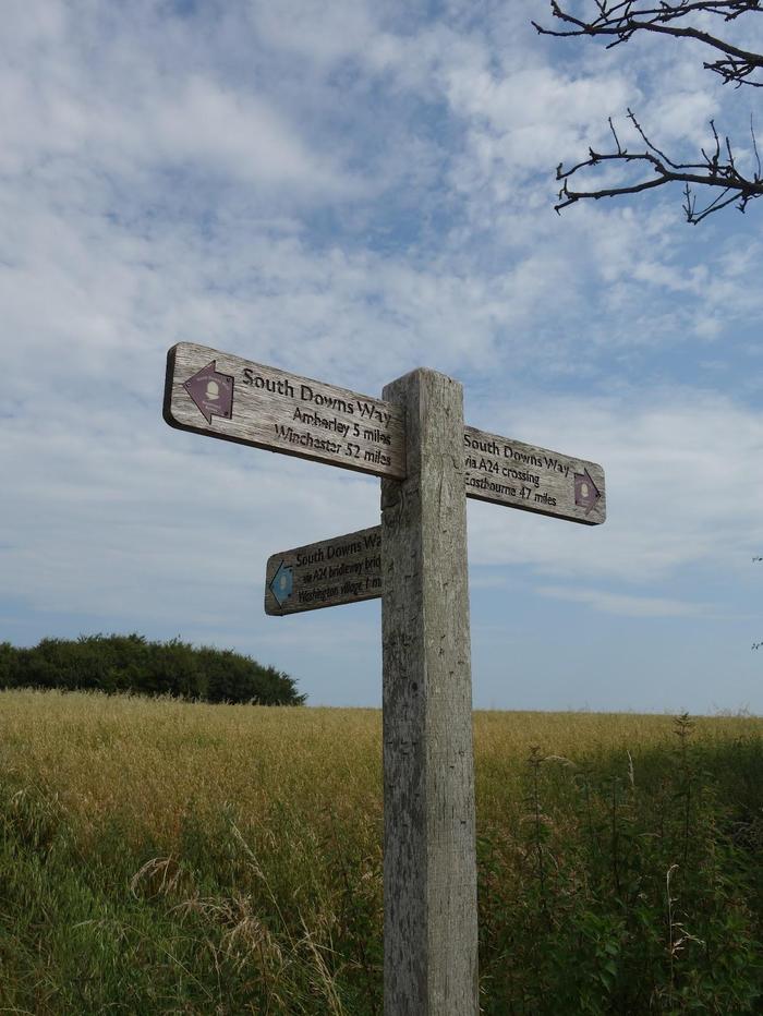
50.8965, -0.43025 - A24 / Washington turning
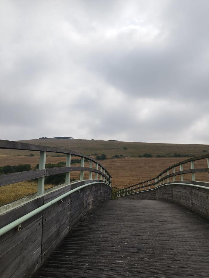
I knew about this turning during research so was on the lookout for it, and I'm glad I took it. Further along the true route is a crossing at the A24 dual carriageway. The traffic is extremely fast with multiple lanes in both directions. This small diversion is also officially signposted as the South Downs Way and provides a footbridge over the A24. I arrived to this point quite early before noon so decided to take a break on top of the hill looking down on Washington.
50.90487, -0.40492 - The Frankland Arms, Washington
Again, planning paid dividends here. The second climb of the day was just after Washington, so I knew I should refuel before tackling it. I waited for the Frankland Arms pub to open and ate a great lunch of scampi and chips.
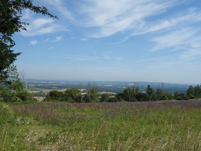
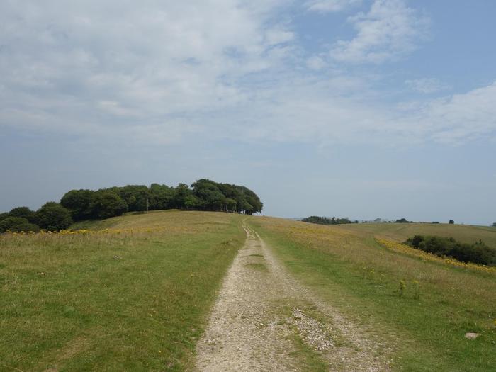
50.89616, -0.38126 - Chanctonbury Ring
The second climb was a long and gruelling one, especially on a hot day. But at the top is Chanctonbury Ring, a prehistoric hill fort with absolutely stunning views. Words and photos cannot do these views justice. This was definitely the highlight of the day.
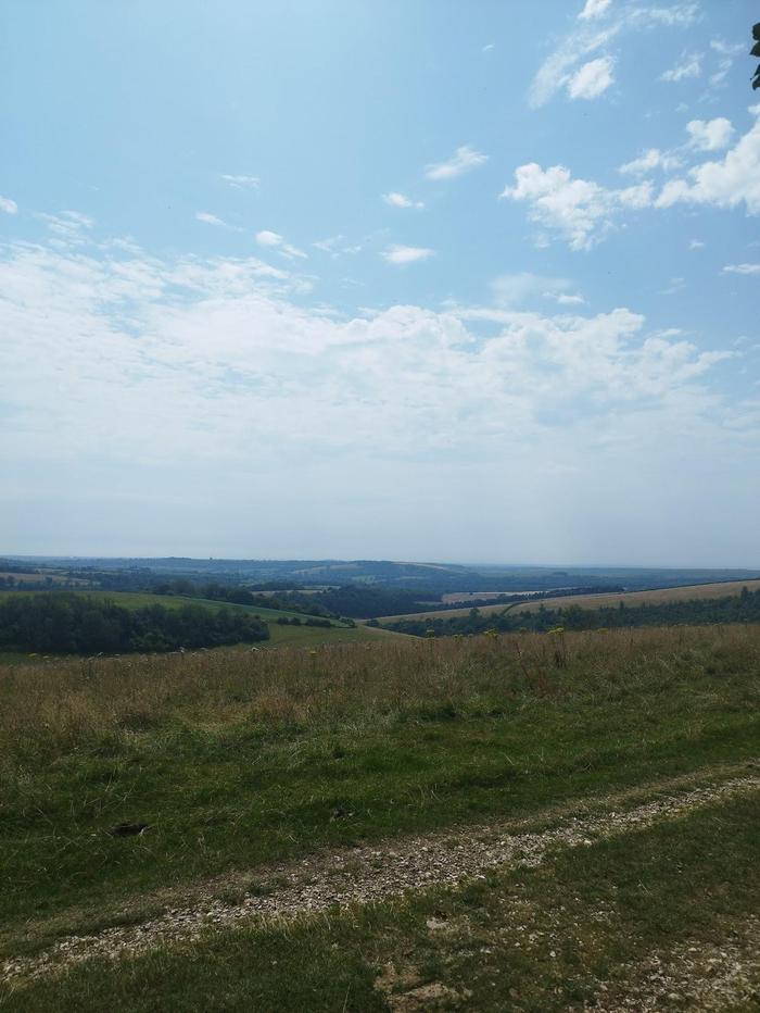
50.87183, -0.34869 - Steyning Bowl
The heat and climbs were definitely taking its toll by this point of the day. Luckily, there are a couple of viewing benches alongside the road overlooking Steyning Bowl. As is with most of the South Downs, amazing views.
50.87126, -0.29937 - Water tap
A very welcome water tap placed right on the way. A bench provides some rest in the shade.
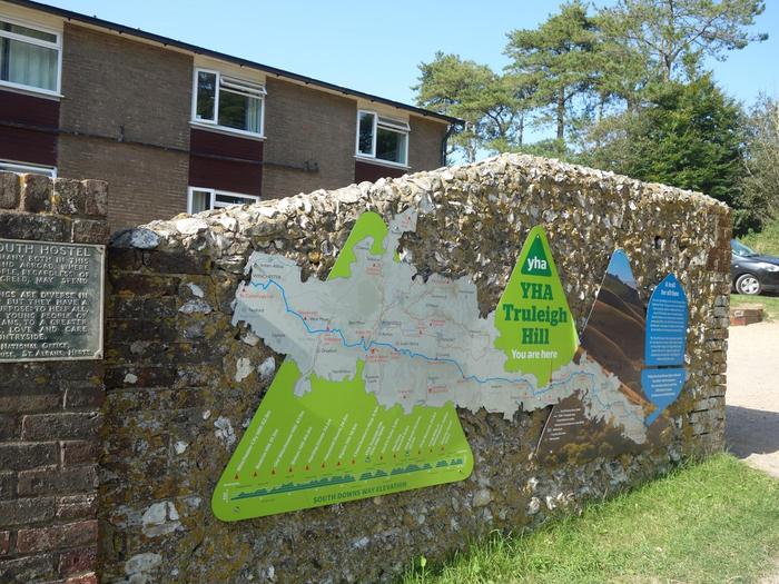
50.88124, -0.26639 - YHA Truleigh Hill (end of Day 4)
After the final climb of the day, which was pretty tough and involved a couple of pauses, the Truleigh Hill hostel is wonderfully presented directly on the South Downs Way. Reception is on the first floor and check-in was straightforward with many aspects of the hostel explained. There are water taps at the entrance to the hostel building. The campsite is on a slight incline, so finding a place to pitch the tent was interesting. The showers and toilets round the back of the hostel building were excellent.
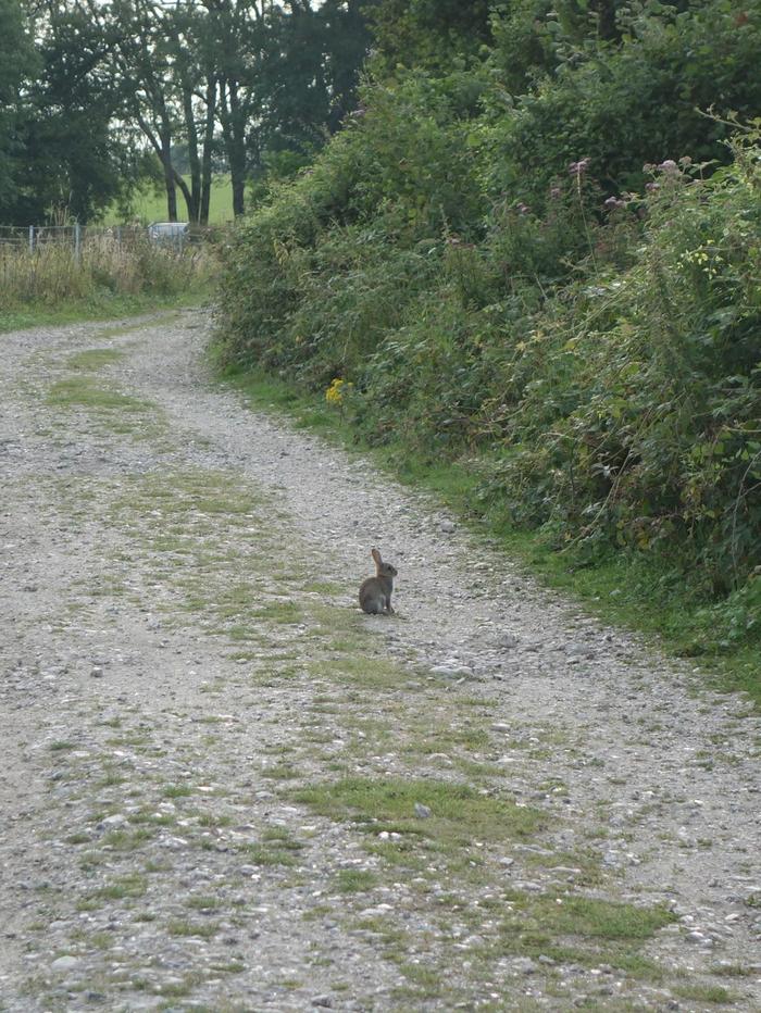
50.88396, -0.25149 - Rabbits! (Day 5)
Being woken up by rabbits nibbling at your tent is a delight to be experienced.
50.89873, -0.16386 - Pyecombe
Much of the morning were rolling hills, but with the dew and light fog not many views were on offer. The small village of Pyecombe marks the half way point of the day. It is flanked by busy roads so feels quite busy. There is an opportunity to fill up water at the church, or turn at Church Lane to pop to the shops for some food. Either way, prepare for a fun ascend up to Ditchling Beacons.
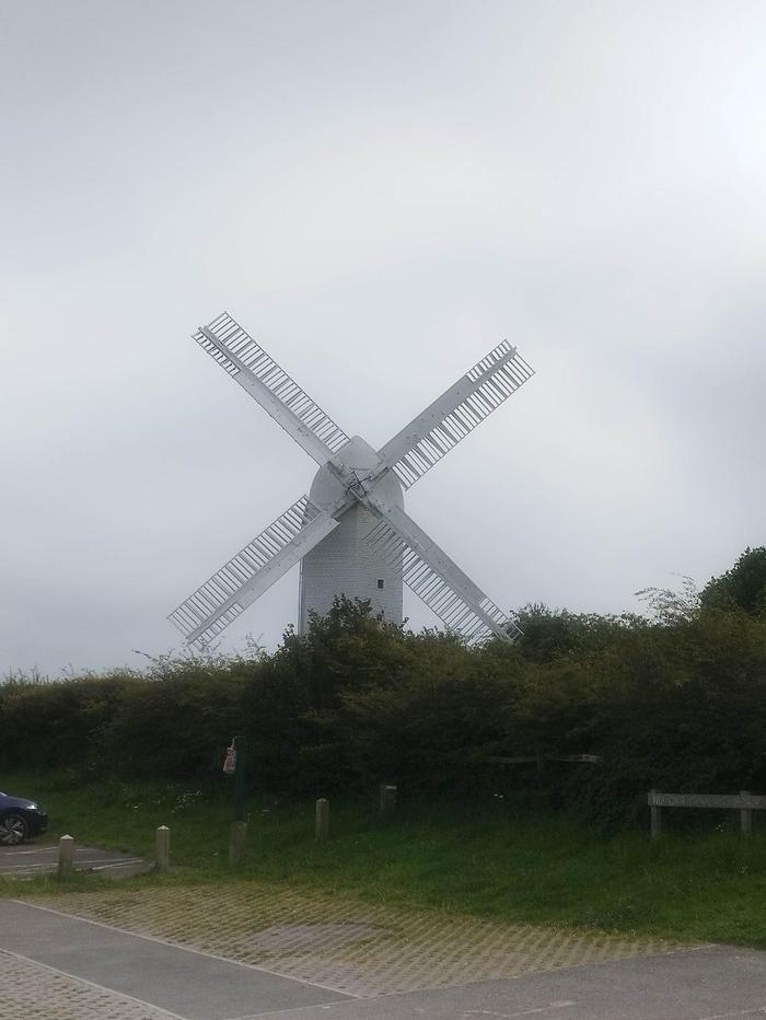
50.90454, -0.14687 - Jack and Jill Windmills
The South Downs Way begins its ascend up to Ditchling Beacons through a golf course. The path gets quite narrow at times. Once a cross road is finally reached, we turn left and approach the Jack and Jill Windmills. Often times, there is a small cafe van open but might be a little hidden behind hedges. They serve plenty of drinks and lovely cakes (who can resist a slice of dense rocky road).
50.90237, -0.108 - Ditchling Beacons
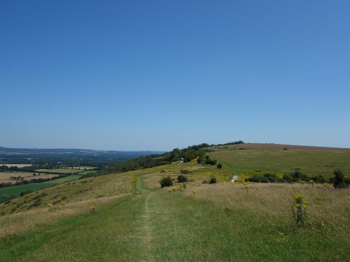
The walk up to Ditchling Beacons is pleasant. Lots of grass to soften the pressure on the feet, and certainly a lot more people on day hikes. The rest of the walk on the other side however was composed of long unending paths and didn't leave much for inspiration. It really just goes on and on. At some point, a sharp right turn is made and the path narrows with hedges either side. Again, it goes on and on.
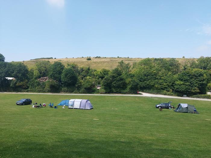
50.8664, -0.05611 - Housedean Farm Campsite (end of Day 5)
Finally, we reach Housedean Farm campsite which is excellent. There is a small farm shop which provides a few food items when it is open. Check-in to the camp was simple as ticking your name off at the shop and finding an empty plot to pitch the tent. The showers and toilets were spotless. The campsite is great place to sunbathe and relax. It does get busier towards the end of the day with more cars driving in and it was very fascinating seeing how elaborate some camping setups can be.
50.85159, -0.04965 - A foggy morning (Day 6)
The climb out of Housedean Farm was pretty tough on this day. The early morning fog and dew meant the air was very humid. Lots of sheep and cows will be grazing on the paths. On a nice day, the views will be really nice. The path here was relatively easy to follow; right on top of the ridge.
50.83333, -0.00158 - The Greenwich Meridian
Within a crop field, and easy to walk straight past, is a fingerpost marking the Greenwich Meridian.
50.83194, 0.03387 - YHA South Downs
YHA South Downs is a highly recommended half way point for the day. They serve a great breakfast bap and was much needed before today's big climb. The climb is pretty tough all the way up but has great views looking back on Southease.
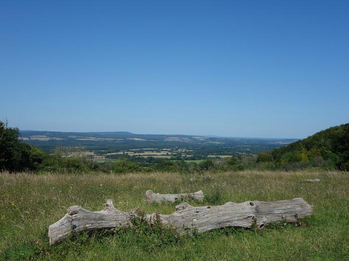
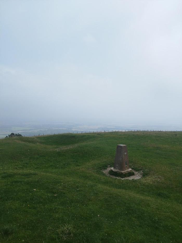
50.83373, 0.10752 - Firle Beacon
The rest of the trail down to Alfriston is across gentle rolling hills. At some point, Firle Beacon trig point offers a lovely view over Charleston. It can get windy up there.
50.80419, 0.14681 - Alfriston (end of Day 6)
The walk into Alfriston village is delightful. Definitely stop by Alfriston Village Store, a small shop with a deli round the back. They make great pasties, sausage rolls and quiches. Stock up before heading over to the campsite just outside the village. Alfriston Camping Park is a pleasant place. Located down a dirt road, it wasn't hard to find. Once past the gates, find a good spot to pitch a tent. Most car campers will take up the middle flatter section. If it looks a little too crowded then try up the small hill along the tree line. Eventually, a few people will drive quad-bikes around asking for payment or online reservation name. The process was simple and they helpfully pointed out the facilities too. If you aren't too tired, I'd recommend taking a shower before heading back into Alfriston for some dinner; there are plenty of pubs to choose from.
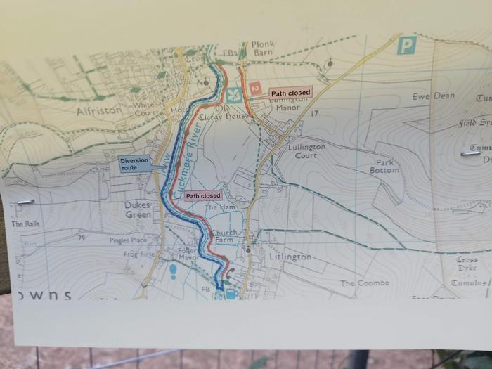
50.80753, 0.15919 - A small diversion (Day 7)
At Cuckmere River, a diversion notice was posted indicating the official South Downs Way down the river was closed. The alternative path was back over the bridge and follows the river on the other side. Not a big diversion at all. A couple of kissing gates made it hard to pass while carrying a large backpack, but wasn't too difficult to overcome with some acrobatics.
50.78129, 0.15759 - Litlington
Passing through Litlington, we start ascending first through a small horse holding and then a couple large flights of steps. A forest makes for an interesting change of scenery, which turns out to also be a mountain bike track.
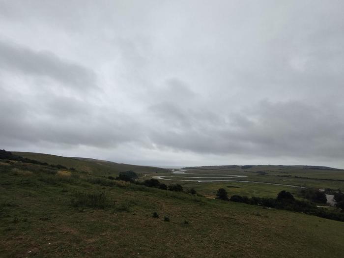
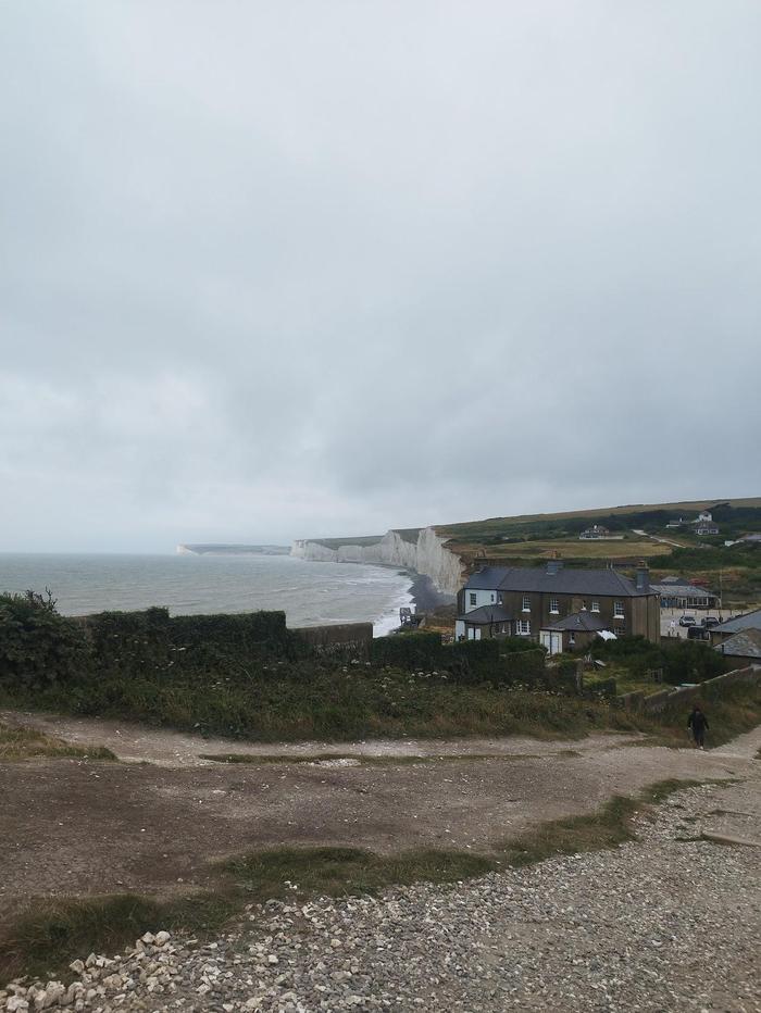
50.77653, 0.15876 - A view towards Cuckmere Haven
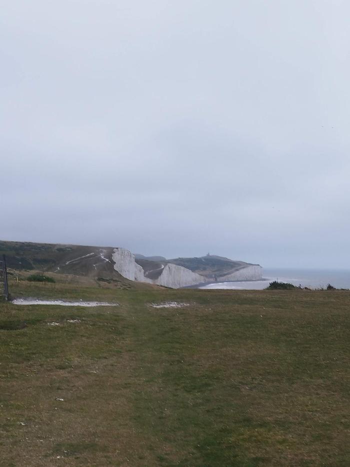
Upon exiting the forest, we are greeted by a stunning view over Cuckmere River and beyond to the English Channel. There are a few options here - either follow the signposts to ascend a hill, or follow the beach path and ascend up to Seven Sisters a little further along. Both are valid routes.
50.74326, 0.20199 - Seven Sisters
Now for the finale. As we keep climbing up to the Seven Sisters, the wind grew much stronger on this particular day which made the final few kilometres a little dangerous. Nevertheless, the undulating path is tough especially after six days of walking. Take your time and look for good foot holes. It'll soon be the end. Toilets are available in Birling Gap.
50.7519, 0.2672 - Eastbourne (end of Day 7)
After passing Bushy Head, we start a steep descent down into Eastbourne. Make sure feet are placed firmly before taking in the view and the finish line. A commemorative sign is available for photos to mark the completion of 100 miles or roughly 170 kilometres of the beautiful South Downs Way. The town of Eastbourne is a few kilometres further, or a bus is available. Would recommend a dip in the sea if weather permits and a large plate of fish and chips. This is one hike I'll certainly remember for a long time.


 51.06718, -1.31971 - Winchester train station (Day 1)